Version 2.7 of the ArcGIS API for JavaScript is now available! Highlights include:
- Superpan map navigation is now the default when using an Apple trackpad or magic mouse. More information is available in the Map Navigation conceptual help topic.
- Feature layers in on-demand mode now automatically generalize features when map scale changes. Refer to the Feature Layer best practices conceptual help topic, specifically the Feature Generalization section, for a detailed explanation.
- Some more ArcGIS Server 10.1 features have been added in this release for those testing the beta software:
- Dynamic layers now allow client applications to specify new renderers for data drawn by the server, add datasets to the map, work with tasks (find, identify, query, and generate renderer), and join data from other resources published with ArcGIS Server.
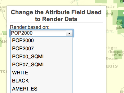
- The ArcGIS API for JavaScript's various layers (dynamic map services and feature layers) as well as tasks (find, identify, query and generate renderer) can now be set to refer to a specific geodatabase version.
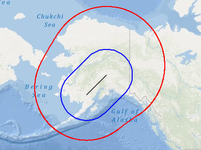
- The geometry service can now perform geodesic buffering.
- Dynamic layers now allow client applications to specify new renderers for data drawn by the server, add datasets to the map, work with tasks (find, identify, query, and generate renderer), and join data from other resources published with ArcGIS Server.
- Additions to the conceptual documentation and several new samples. See What’s New in 2.7 for a complete list.
Contributed by Derek Swingley of the ArcGIS API for JavaScript development team.
No hay comentarios:
Publicar un comentario